Snapp Ocean Data
Non-intrusive and end-to-end data collection.
Our work integrates cutting-edge non-intrusive robotics, data science platforms, and scientific community expertise, to provide actionable insights for data-driven decision making.
At Snapp we understand that data is crucial for sensible actions in our environments and is the foundation for collaborative decision making. Sustainably inhabiting and managing our environments comes down to having a common understanding. The services and tools we provide aim to enhance our collective efforts towards a more habitable planet.
Our Services
-

Water Quality Reporting
Baseline water quality assessment
Ground-truthing and scouting
KPI verification for policy and management
Data collection for science studies
-

Aquaculture Support
Science-based reporting
Drone assisted underwater sensing and observation
Nutrition and waste monitoring
Environmental stress monitoring
-

Biodiversity Monitoring
eDNA water sampling
Machine-learning assisted underwater species classification
Environmental stress tracking and mapping
Underwater imaging and modelling
What we offer
Non-intrusive Fish-like Drone

Agile and powerful. Deploy our fish-like robot to enhance your monitoring efforts by mitigating costs/risks and scaling up operations.
Underwater Imagery & Mapping

See below the water surface, with standard or 360 underwater imagery to enhance in-person observation as well as aerial/satellite based imagery.
Remote Sensor Suite & Water Sampler

Get underwater data remotely with a deployable kit of sensors and water samplers for both in-situ and lab-based data collection.
Cloud-based Data Repository

Access data without leaving the desk. In-situ data collection is directly delivered to an accessible online repository.
Web-app Dashboard

Be informed in near real-time or monitor changes across extended periods directly through our web-app service with data visualized for actionable insights.
Data Science Platform

Transform, share, and aggregate data from our online platform, equipped with GIS integrations and API services to unlock opportunities for applications.

Why work with SNAPP?
Non-intrusive and safe underwater data collection
Deploy our non-intrusive fish-like drone to de-risk your operations while minimizing ecological impact and reducing logistical costs. We design the deployment and mobility solutions fitted for the needs of every project.
Data-driven projects for positive ecological impact
We assist in steering projects where data is crucial for achieving consensus in the governance around complex ecological systems. Our work connects the dots between stakeholders through our data science platform and provides insights through our growing scientific community network.
We provide an end-to-end data collection and delivery service to bring insights on your projects. Partner with us to protect the ocean, monitor environmental risks, fulfill your ESG goals, or grow your blue carbon assets.
Regular monitoring in aquatic environments
Our growing network of scientific experts are here to transform gathered data into actionable insights. We work with our scientific experts to develop robust data collection methods, and implement them through innovative technology.
Deploy scientific community expertise
How we work with you

1) Project Partnership
Work with us to define your scope, metrics, and necessary insights. Align your goals with the internationally recognized frameworks and industry-specific standards.

2) Continuous Monitoring
Our team follows industry and scientific standards for your data collection needs. Utilize our novel robotic fish to access difficult environments and maintain minimal disturbance.

3) Actionable Insights
We transform collected data into actionable insights. Through our collaboration with experts and in-house analysis tools, we bring you information in the form you need.

4) Dynamic Reporting
Customize your reporting requirements with us to enhance dataset management and dissemination needs. Automate your reporting pipeline with interactive web-apps and API services.
Our way is non-intrusive
We deploy novel soft robotics technology to achieve minimal environmental disturbance, while still being able to navigate difficult terrains for data collection surveys.
Current Project Sites
-
![Four people standing outdoors near a body of water, holding model rockets, with a cloudy sky and green landscape in the background.]()
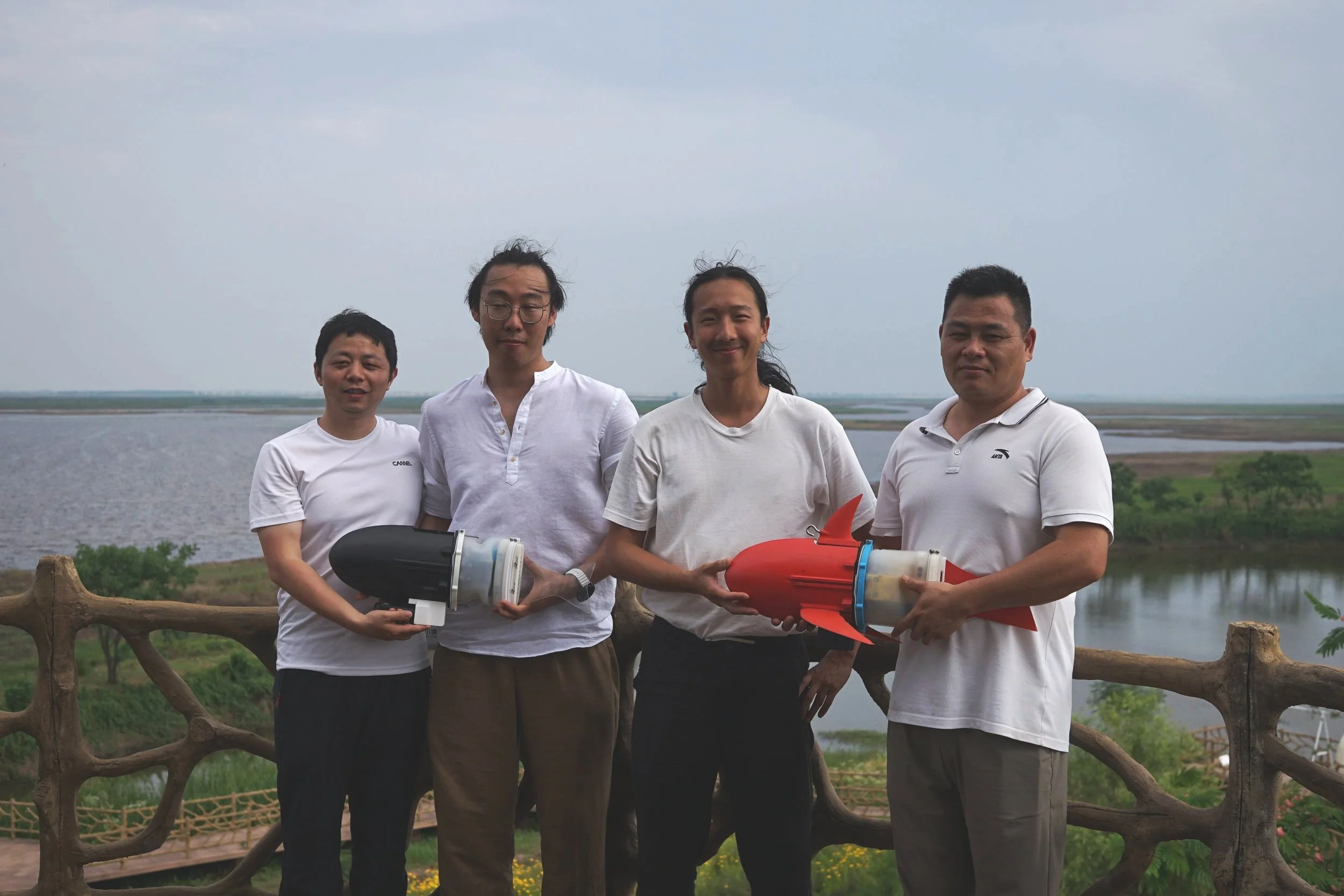
Poyang Lake, Jiangxi, China
-
![Two people on a floating platform by a lake, one crouching and working with equipment, the other standing and observing, with a city skyline and cloudy sky in the background.]()
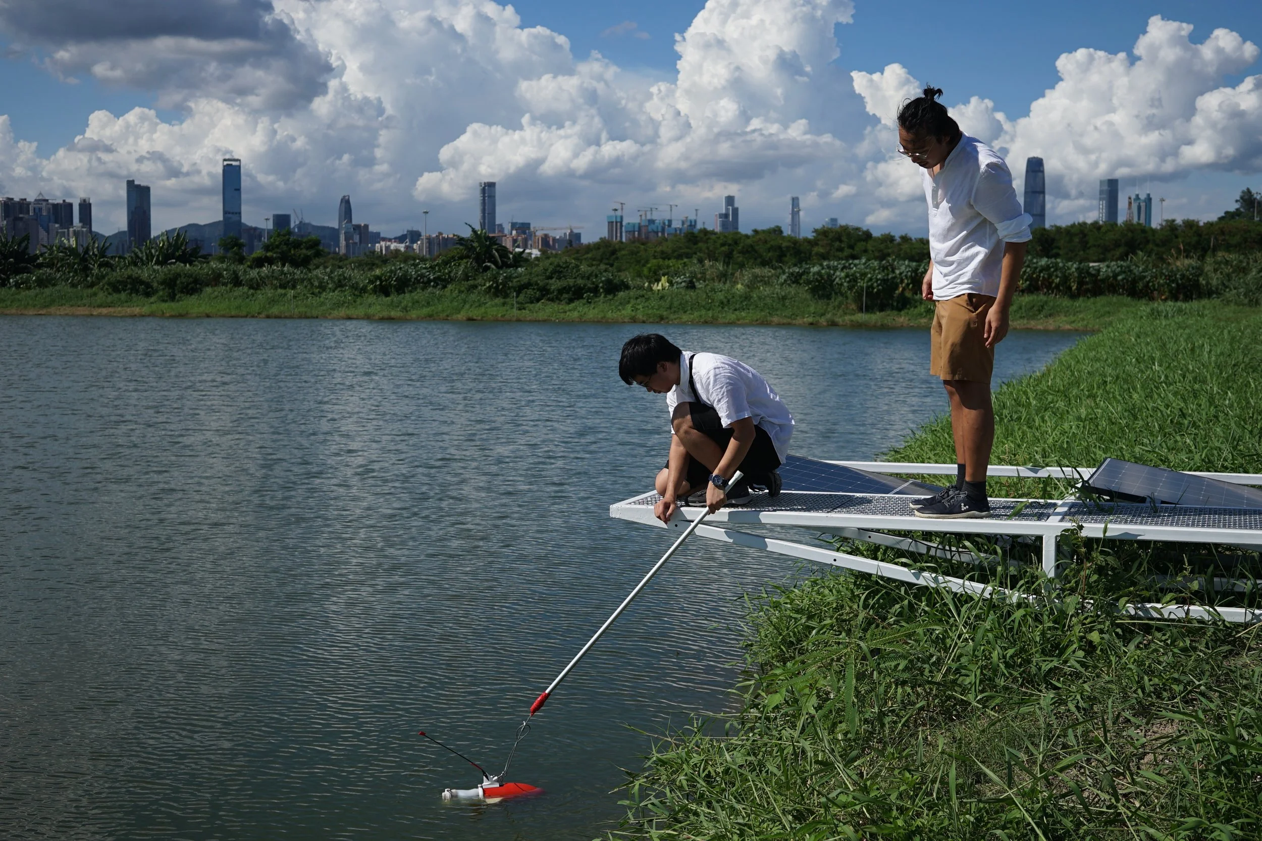
San Tin Fishponds, Hong Kong SAR
Our work has been supported and recognized by:


